Mining Monitoring
Monitoring of licensed and illegal mining, including small artisanal sites, for governments, operators and NGOs.
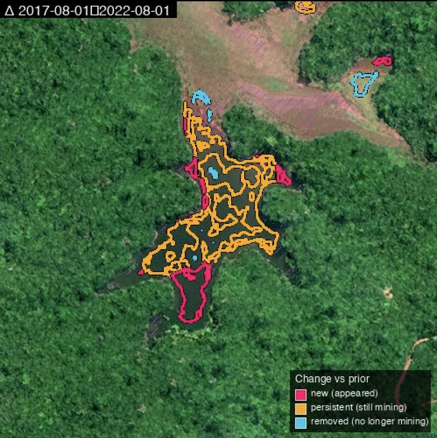
Mining is conducted at scale in many countries, licensed and illegal, often in remote places. When illegal, operations are usually artisanal, small and hard to identify. Mining monitoring is used for various purposes:
- Government-level monitoring of licensed sites progression and potential license violation and impact on the surrounding area, such as nearby tree logging, road and infrastructure expansion, nearby natural terrain like waterways and pools, and open pit progress
- Government-level monitoring of illegal sites, often artisanal and small
- Commercial operation monitoring of own mines, sometimes a large number distributed over a large area and possibly multiple countries
- Commercial operation monitoring competitors' activity and progress
- NGOs monitoring mining, licensed and illegal, and its impact on the environment
- Supply-chain due diligence (proving where minerals come from)
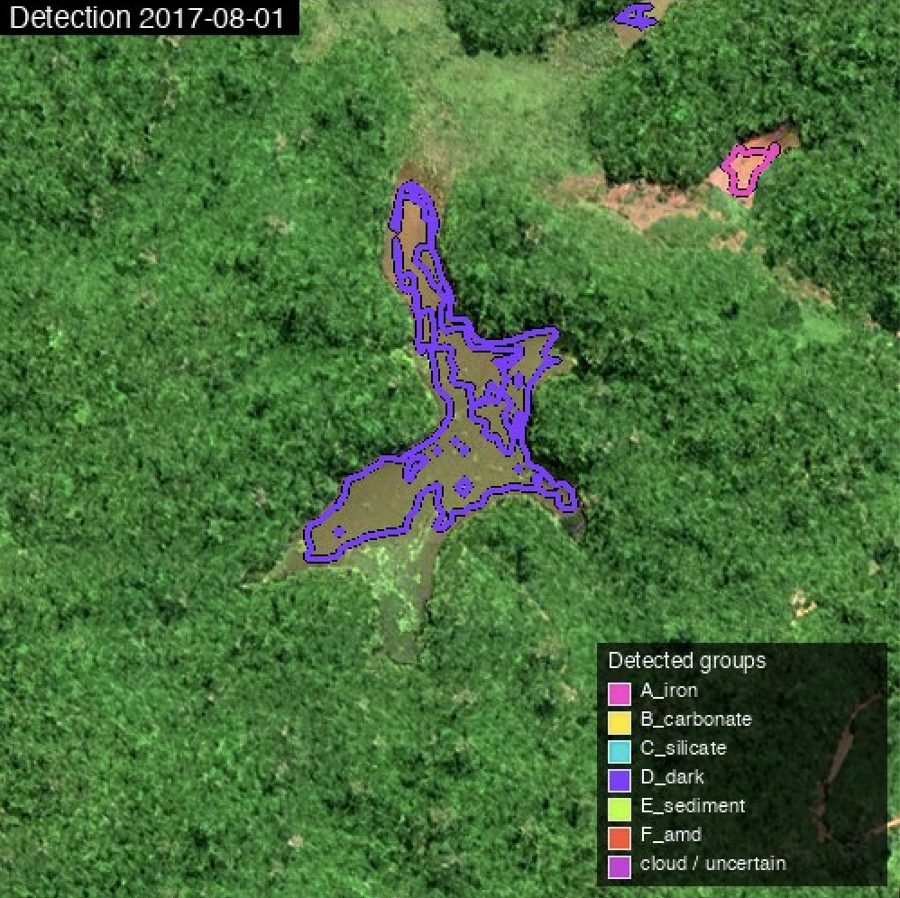
EarthToDate Mining Monitoring classifies each detection from 2m multispectral data into six spectral groups:
- Iron-rich exposed subsoil — artisanal gold, iron ore, bauxite, manganese, nickel laterite
- Carbonate quarries — limestone, marble, dolomite, chalk
- Bright silicate and quartz — granite quarries, sand and gravel pits, kaolin and clay pits
- Coal and dark organic-rich material — coal pits and spoil heaps, peat extraction, sulfide tailings
- Sediment-laden water — amalgamation and sluice ponds, sand-mining turbidity, tailings, dredging
- Acid mine drainage — iron-oxidized water from sulfide mining
Detections are grouped into sites rather than single pixels, and two dates can be compared per site: same, appeared, disappeared, grown or declined. The 1m visual imagery is used to confirm and characterize each site.
The 2m data matters most for small sites: sub-hectare artisanal pits, small coal pits and spoil heaps, ponds 10–20m across and narrow contaminated streams. Large quarries and open pits are already visible in 10m Sentinel-2, where the gain is sharper boundaries.
Mining Monitoring was validated against the Tang & Werner 2023 reference (12 areas, five continents) and found to identify 100% of mining areas and 85% of mining type signature. However, false positives are expected in industry, sewage and other signal sources, and expert reading of the monitoring data is needed for actual production on-going.
What you receive
Mining site detections and their changes between your dates