ESRI Basemap Age
An age map of ESRI World Imagery, so users know how current the imagery is for their use case; a fused up-to-date version is coming soon.
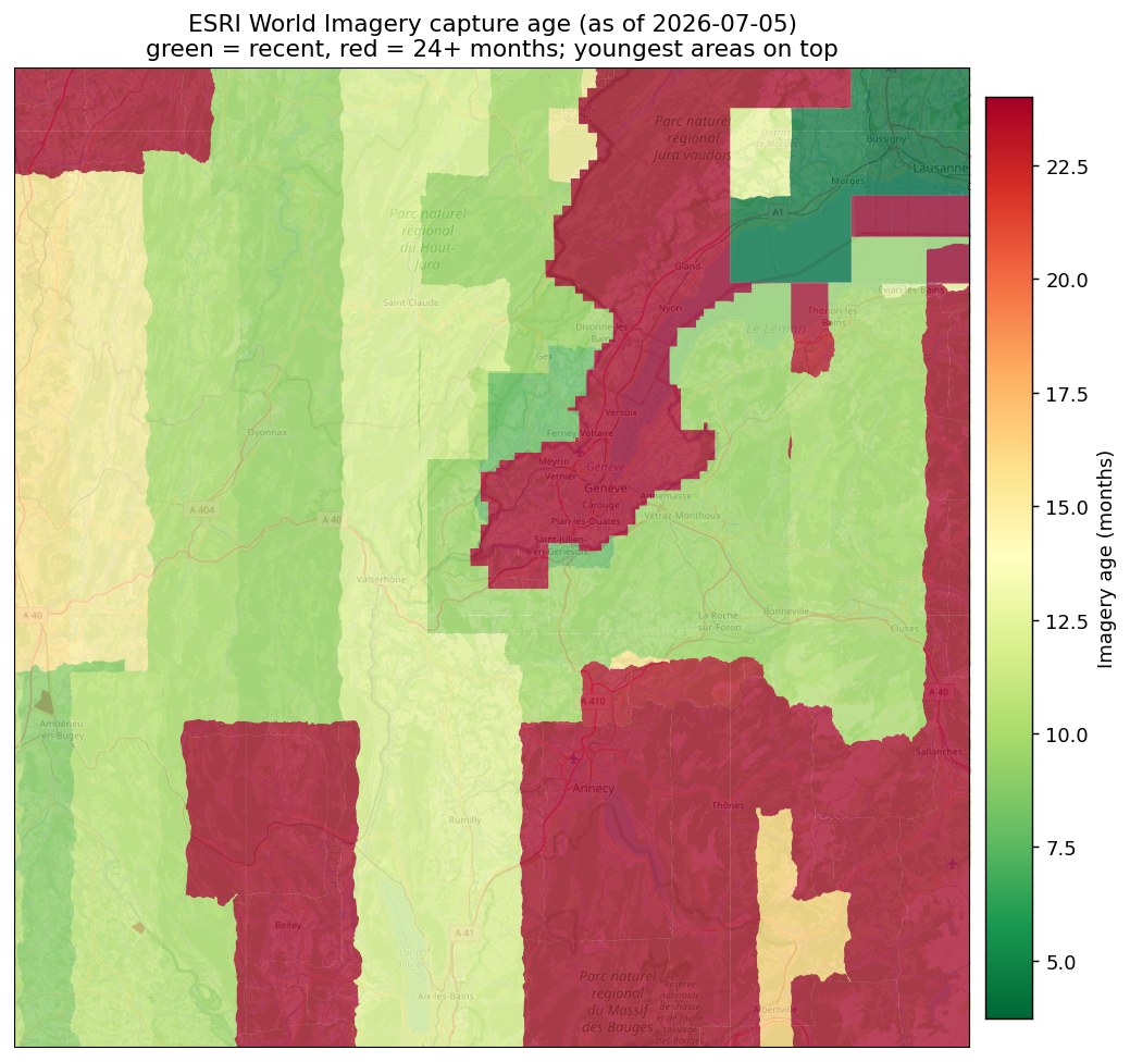
ESRI has licensed various satellite imagery sources, most notably the Vantor (formerly Maxar) Vivid basemap, and provides it as ESRI World Imagery: 0.3m in select metropolitan areas, 0.5m across the United States and parts of Western Europe, and 1m elsewhere. Updates are partial — Vantor aims to refresh areas of frequent change, about 30 million km² or roughly a fifth of the land, once a year, other areas every other year, and only selected major cities more often. Much of the world can therefore be shown with imagery several years old. ESRI provides licensing terms for the use of ESRI World Imagery, but it is primarily available to licensed ESRI users.
EarthToDate supports ESRI users using ESRI World Imagery by producing an age map, allowing users to adjust their expectations of the imagery and its fit for their particular use case.
Note that a fused product is coming up soon: ESRI World Imagery with:
- Non-artificial areas like fields, forests and parks presented as up-to-date EarthToDate 1m visual data
- Artificial areas not present in ESRI World Imagery presented as up-to-date EarthToDate 1m visual data, which is not equal in quality to ESRI World Imagery but does give an indication of the truth on the ground
- Artificial areas like urban areas, houses and roads keeping their original ESRI World Imagery clarity and detail
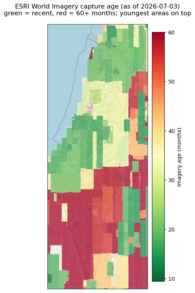
What you receive
A per-location imagery-age map of the ESRI World Imagery basemap