Enhanced Visual
Sentinel-2 & PlanetScope → 1m Refined Reality
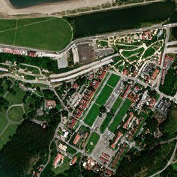
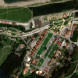
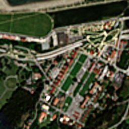
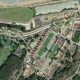
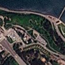
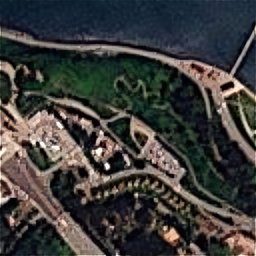
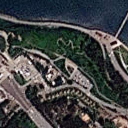
Visual imagery is the universal base layer for every monitoring task — the picture a human analyst reads directly. The constraint has always been the trade-off between resolution and refresh: commercial very-high-resolution scenes resolve detail but are tasked, expensive, and infrequent, while free wide-coverage sources like Sentinel-2 refresh often but blur out everything below 10 metres.
EarthToDate breaks that trade-off. Our Refined Reality processing enhances Sentinel-2 to a true 1m and PlanetScope to 1.9m using physics-based reconstruction and calibrated ML sharpening — never inventing detail. Geolocation accuracy is identical to the source, so measurements, overlays, and change detection stay trustworthy.
Updates land every 2–5 days worldwide with a 10-year archive behind them, plus 50–75cm super-resolution options where extra detail is worth it. The result is the cadence of an operational monitoring service at a resolution previously reserved for one-off tasked collection.
Frequently asked questions
What is Enhanced Visual?
Visual imagery is the universal base layer for every monitoring task — the picture a human analyst reads directly. The constraint has always been the trade-off between resolution and refresh: commercial very-high-resolution scenes resolve detail but are tasked, expensive, and infrequent, while free wide-coverage sources like Sentinel-2 refresh often but blur out everything below 10 metres.
What data and resolution does Enhanced Visual use?
Physics-based 1m true-color, refreshed every 2–5 days, with no super-resolution hallucinations. (Sentinel-2 & PlanetScope → 1m Refined Reality)