Agriculture
Agriculture lives and dies by timing. A disease focus, a failed emitter, or a creeping salinity front costs little if caught in its first week and a whole season if caught late. The limiting factor has been resolution and revisit: episodic site visits and 10m satellite pixels both miss problems until they have already spread.
EarthToDate turns Sentinel-2's frequent revisit into operational intelligence at 2m and below. The same enhanced multispectral stack drives early anomaly detection, soil moisture and salinity, biomass, and the classic vegetation indexes — all sharing one geometry and a 10-year archive.
The result is a continuous, field-scale agronomic picture: where stress is starting, how water and salt are moving, and how forage and crop vigour compare across an operation — without tasking, per-area pricing, or cloud dependence on any single pass.
Solutions for this industry
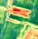
Field Anomaly Detection
Catches divergence at 4×4m — disease, pests, weeds, irrigation faults — weeks before it's visible at field scale.
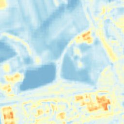
More info →Soil Moisture & Salinity
Field-scale moisture and a 0–100 salinity score, correct across the full range of conditions.
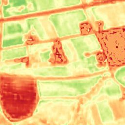
More info →Grassland Biomass
A 2m biomass index auto-calibrated to geography, ranking grazing fields with 90%+ correctness.
More info →Data sources behind them
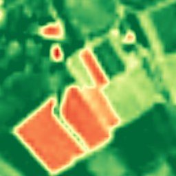
Enhanced Multispectral
Ten calibrated spectral bands at 2–4m — the analytical engine behind NDVI, moisture, burn, and mineral indexes.
More info →
Enhanced Visual
Physics-based 1m true-color, refreshed every 2–5 days, with no super-resolution hallucinations.
More info →Frequently asked questions
How does EarthToDate serve Agriculture?
Agriculture lives and dies by timing. A disease focus, a failed emitter, or a creeping salinity front costs little if caught in its first week and a whole season if caught late. The limiting factor has been resolution and revisit: episodic site visits and 10m satellite pixels both miss problems until they have already spread.
Which EarthToDate products apply to Agriculture?
Solutions: Field Anomaly Detection, Soil Moisture & Salinity, Grassland Biomass. Data sources: Enhanced Multispectral, Enhanced Visual.
Why EarthToDate over the alternatives?
The result is a continuous, field-scale agronomic picture: where stress is starting, how water and salt are moving, and how forage and crop vigour compare across an operation — without tasking, per-area pricing, or cloud dependence on any single pass.