Grassland Biomass
Tonnes per hectare, auto-calibrated
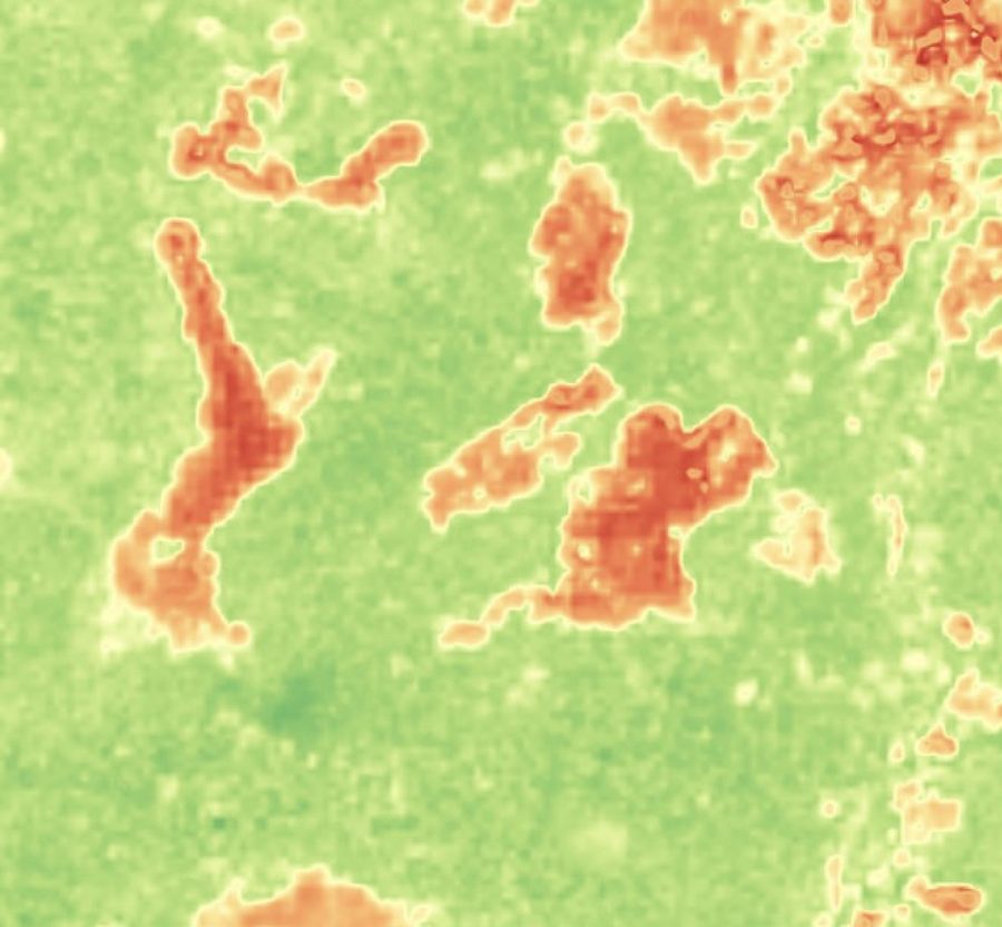
Graziers and rangeland managers need to know which paddock to move stock to next — a relative ranking of standing biomass across fields, refreshed often enough to act on.
EarthToDate computes a composite biomass index at 2m from the full 10-band multispectral stack, auto-calibrated to local geography so it works without per-site tuning. Relative accuracy runs ±15–20%, ranking fields correctly more than 90% of the time.
Built for the next grazing decision rather than scientific carbon accounting, it gives a consistent, frequently-updated view of where forage is and how it is changing across an operation.
Frequently asked questions
What is Grassland Biomass?
Graziers and rangeland managers need to know which paddock to move stock to next — a relative ranking of standing biomass across fields, refreshed often enough to act on.
What data and resolution does Grassland Biomass use?
A 2m biomass index auto-calibrated to geography, ranking grazing fields with 90%+ correctness. (Tonnes per hectare, auto-calibrated)