Elevation (BaseDEM)
Worldwide 1m DEM, LiDAR-grade
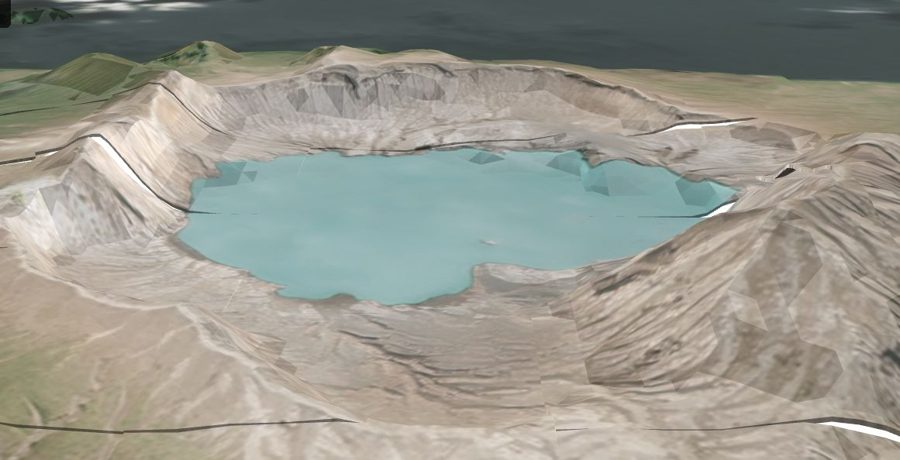
Terrain is the hidden input behind flooding, erosion, drainage, line-of-sight, drill targeting, and earthworks. Yet public DEMs (SRTM, ASTER, Copernicus) are 30m with 5–16m vertical error — far too coarse for parcel- or channel-scale work — and survey-grade LiDAR is expensive, episodic, and unavailable for most of the world.
EarthToDate BaseDEM delivers 1m horizontal and 0.5–1m vertical accuracy globally, resampled to 1m with 3–4m effective spatial detail. Independent reviewers place it within a metre, vertically, of airborne LiDAR — as a consistent, worldwide product rather than a one-off survey.
It is offered in tiers from Base through higher-accuracy variants for agriculture and construction, and it underpins ETD's flood simulation, GLOF discharge modelling, fire-cascade erosion maps, and mining volumetrics.
Frequently asked questions
What is Elevation (BaseDEM)?
Terrain is the hidden input behind flooding, erosion, drainage, line-of-sight, drill targeting, and earthworks. Yet public DEMs (SRTM, ASTER, Copernicus) are 30m with 5–16m vertical error — far too coarse for parcel- or channel-scale work — and survey-grade LiDAR is expensive, episodic, and unavailable for most of the world.
What data and resolution does Elevation (BaseDEM) use?
A global 1m elevation model within a metre of LiDAR — the terrain layer no free or commercial product matches. (Worldwide 1m DEM, LiDAR-grade)
Where and how often is it available?
EarthToDate BaseDEM delivers 1m horizontal and 0.5–1m vertical accuracy globally, resampled to 1m with 3–4m effective spatial detail. Independent reviewers place it within a metre, vertically, of airborne LiDAR — as a consistent, worldwide product rather than a one-off survey.