Water & Utilities
Utilities operate vast, mostly-buried, mostly-linear networks that leak, get encroached on, and fail out of sight. The economics of tasked satellite imagery have kept satellite monitoring to one-off studies rather than the continuous, network-wide service the problem demands.
EarthToDate's systematic 2–3 day coverage changes the unit economics: an entire national network can be monitored on one schedule, priced per kilometre or per area, instead of paying tasking fees for each pass.
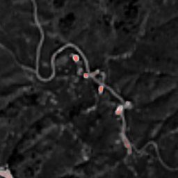
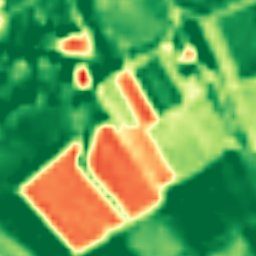
Suspected Water Leak Warnings detects subsurface moisture anomalies along pipeline routes at 2m; Corridor Watching tracks encroachment and change along any linear asset; and BaseDEM underpins gravity-flow and grade analysis of the network itself.

Solutions for this industry
Data sources behind them
Enhanced Multispectral
Ten calibrated spectral bands at 2–4m — the analytical engine behind NDVI, moisture, burn, and mineral indexes.
More info →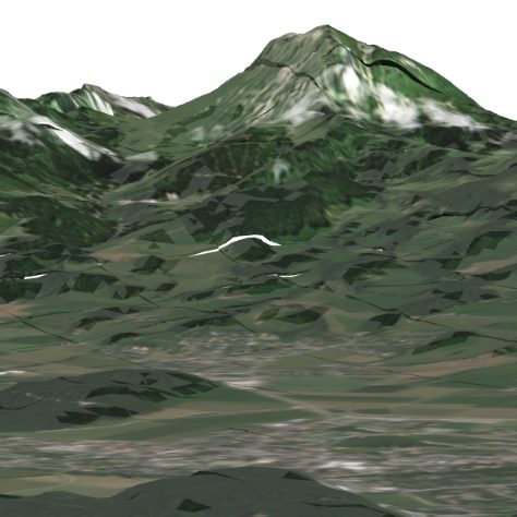
Elevation (BaseDEM)
A global 1m elevation model within a metre of LiDAR — the terrain layer no free or commercial product matches.
More info →Frequently asked questions
How does EarthToDate serve Water?
Utilities operate vast, mostly-buried, mostly-linear networks that leak, get encroached on, and fail out of sight. The economics of tasked satellite imagery have kept satellite monitoring to one-off studies rather than the continuous, network-wide service the problem demands.
Which EarthToDate products apply to Water & Utilities?
Solutions: Suspected Water Leak Warnings, Corridor Watching. Data sources: Enhanced Multispectral, Elevation (BaseDEM).
Why EarthToDate over the alternatives?
Suspected Water Leak Warnings detects subsurface moisture anomalies along pipeline routes at 2m; Corridor Watching tracks encroachment and change along any linear asset; and BaseDEM underpins gravity-flow and grade analysis of the network itself.