Flood Simulation
Water reach from any height

Flood-risk planning needs to answer a concrete question: if the water reaches a given height here, exactly which streets, buildings, and assets go under? Answering it credibly depends entirely on terrain accuracy — and public 30m DEMs blur out the very kerbs, embankments, and drainage lines that decide where water actually goes.
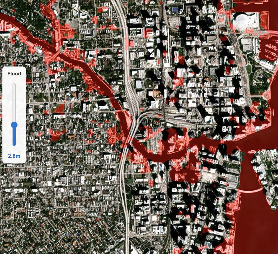
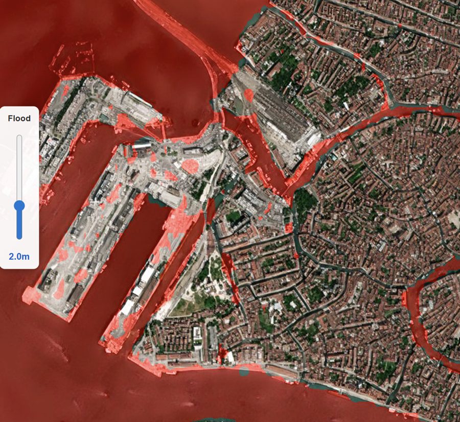
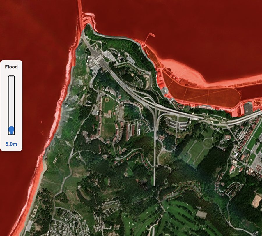
EarthToDate flood simulation runs over BaseDEM at 0.5–1m vertical accuracy, letting you set any minimum water level at an AOI and see the resulting inundation footprint rendered over Refined Reality 1m imagery. The reach is a real terrain computation, not a coarse approximation.
It supports coastal storm-surge and sea-level scenarios, riverine and urban flooding, and the downstream flows from dam-breach or post-fire debris cascades — the same terrain engine behind ETD's GLOF and fire-cascade products, applied wherever water meets elevation.
Frequently asked questions
What is Flood Simulation?
Flood-risk planning needs to answer a concrete question: if the water reaches a given height here, exactly which streets, buildings, and assets go under? Answering it credibly depends entirely on terrain accuracy — and public 30m DEMs blur out the very kerbs, embankments, and drainage lines that decide where water actually goes.
What data and resolution does Flood Simulation use?
Simulate inundation to any water level over 1m imagery, driven by 0.5–1m BaseDEM accuracy. (Water reach from any height)